
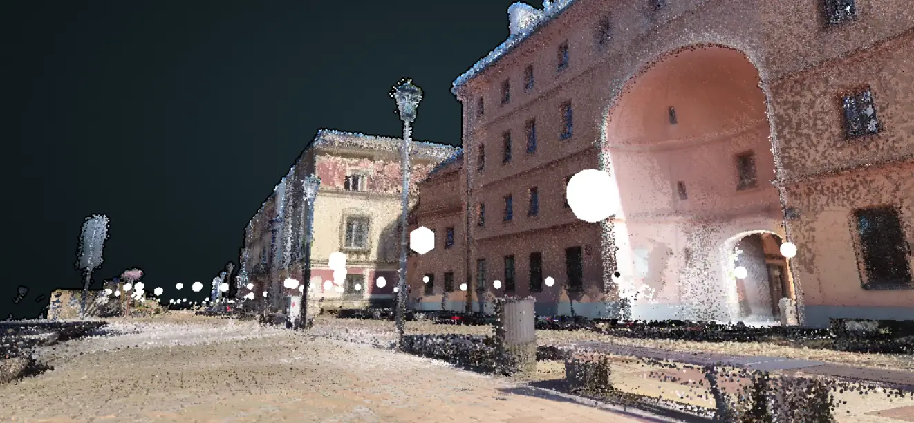
3D Laser Scanning and Photogrammetry
Our data provides a reliable foundation for design, analysis, and BIM processes.
ABOUT COMPANY
Setting New Measurement Standards
We operate certified measurement systems - terrestrial laser scanners (TLS) and UAV platforms – using professional software for data capture, filtering, and integration. Every project is executed under strict quality control at all stages.

Certified Technology
We use TLS systems and UAV platforms, ensuring strict quality control at every stage of the surveying and data processing workflow.

Engineering Expertise
A team of surveying and civil engineering professionals delivering projects both domestically and internationally.

Comprehensive 3D Deliverables
End-to-end process: from on-site data acquisition to final 3D models and engineering analyses.
SERVICES RANGE
Services Range
Data Integration
Merging TLS and UAV point clouds, georeferencing, coordinate system transformations, and data export to GIS and BIM platforms. Integration of multi-source measurement data.
- Georeferencing and coordinate system transformations
- Combining multi-source measurement data
- Export to GIS, BIM, and management platforms
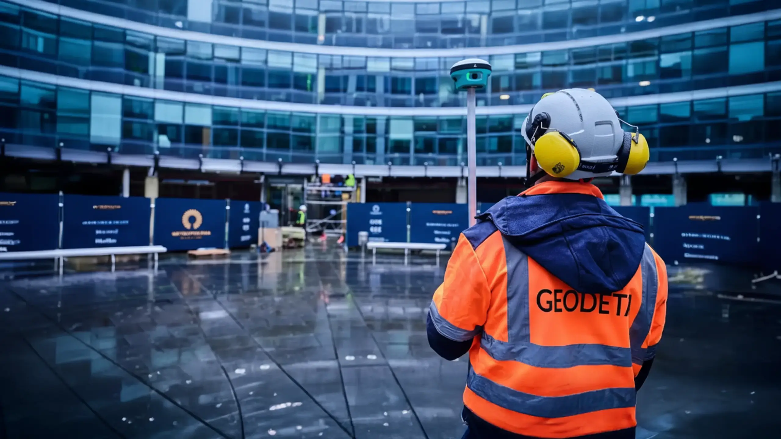
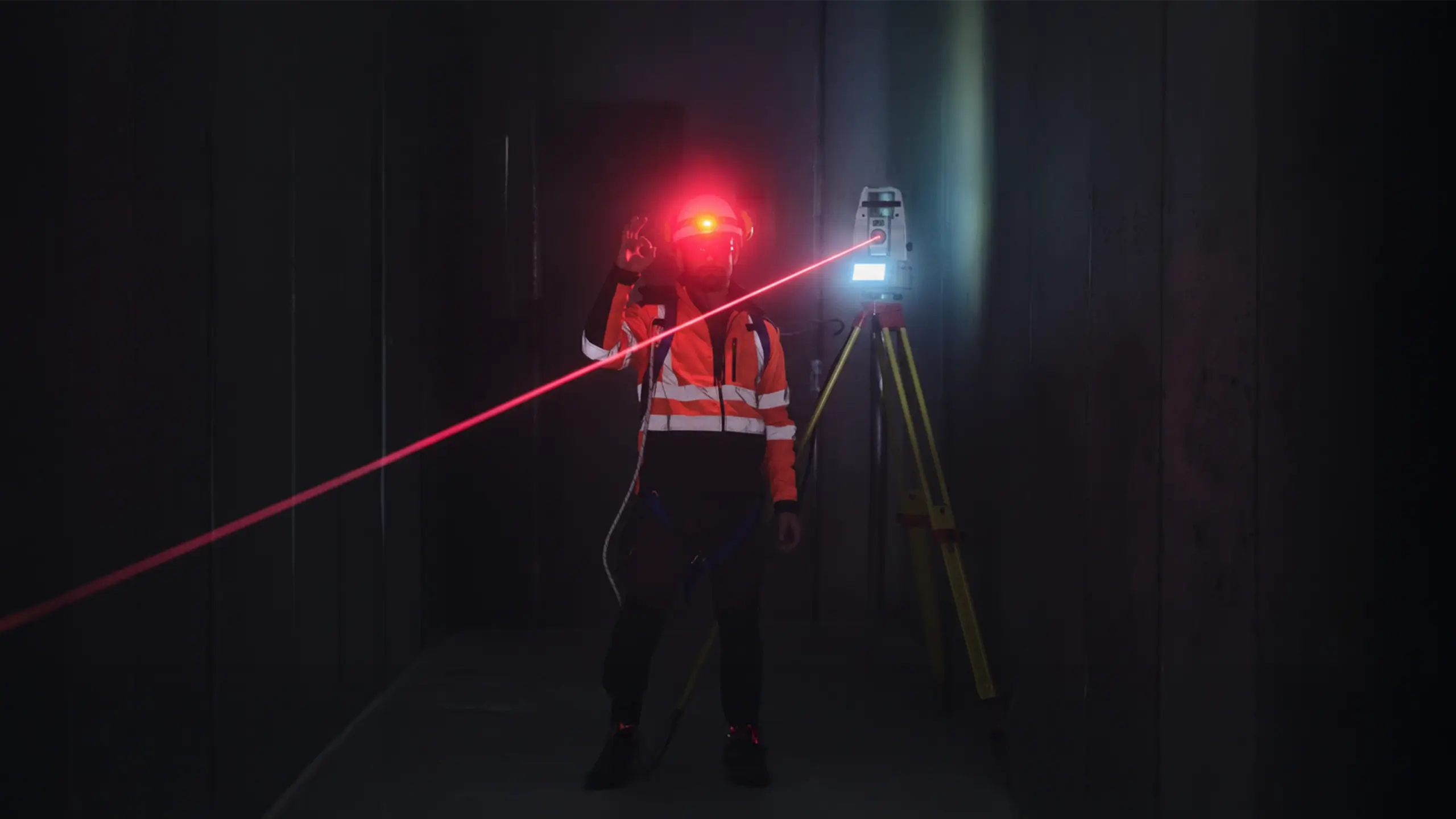
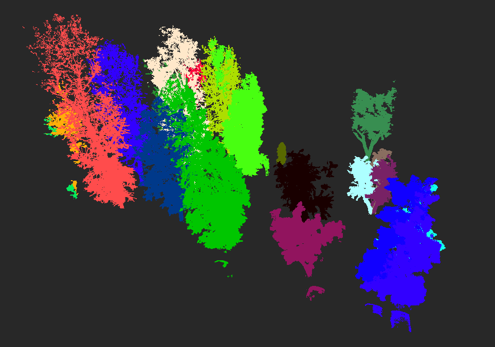
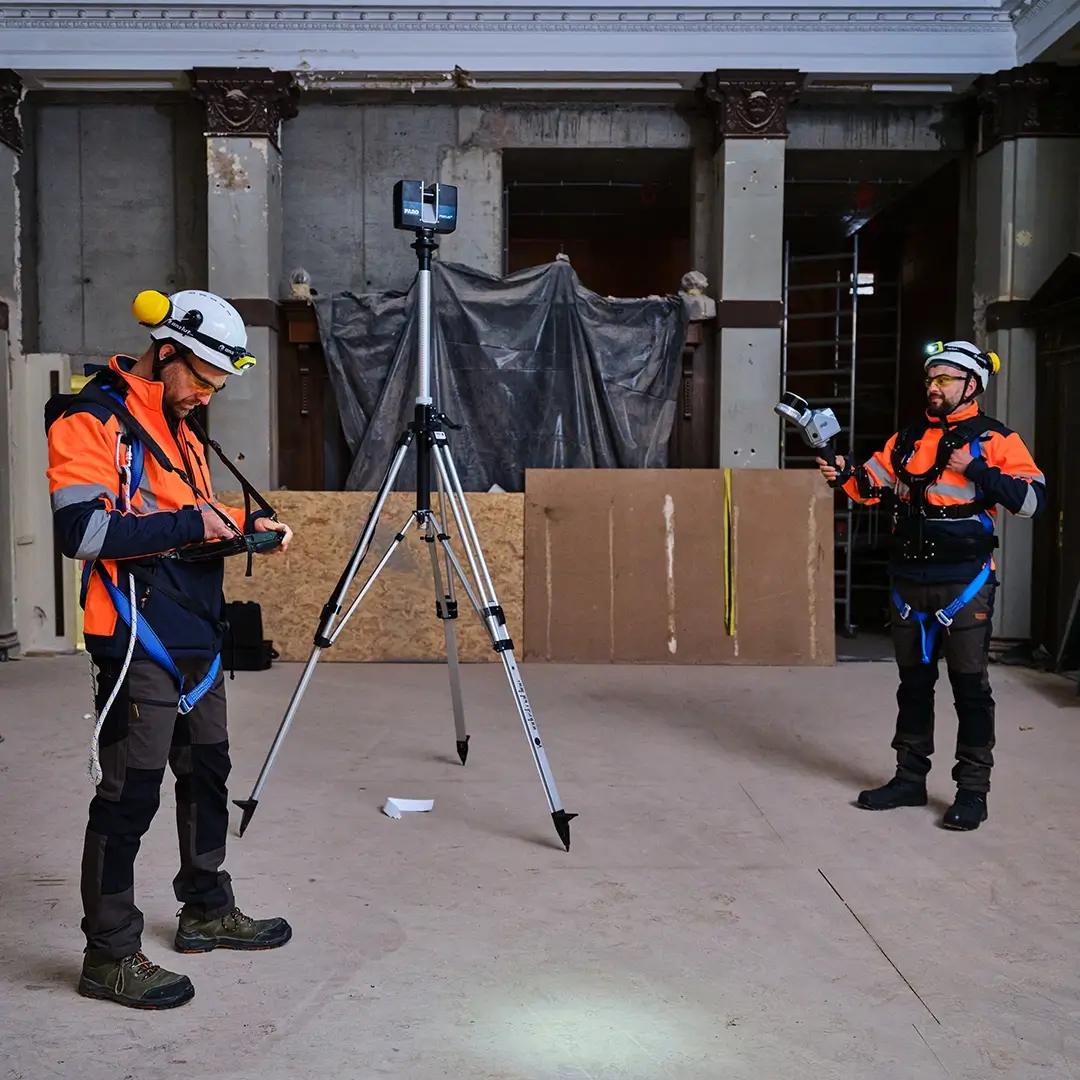
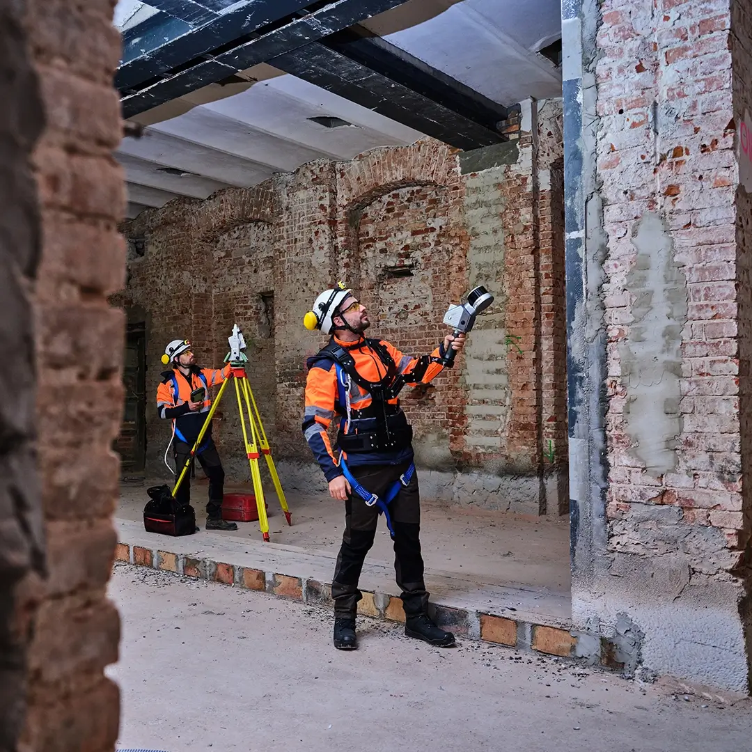
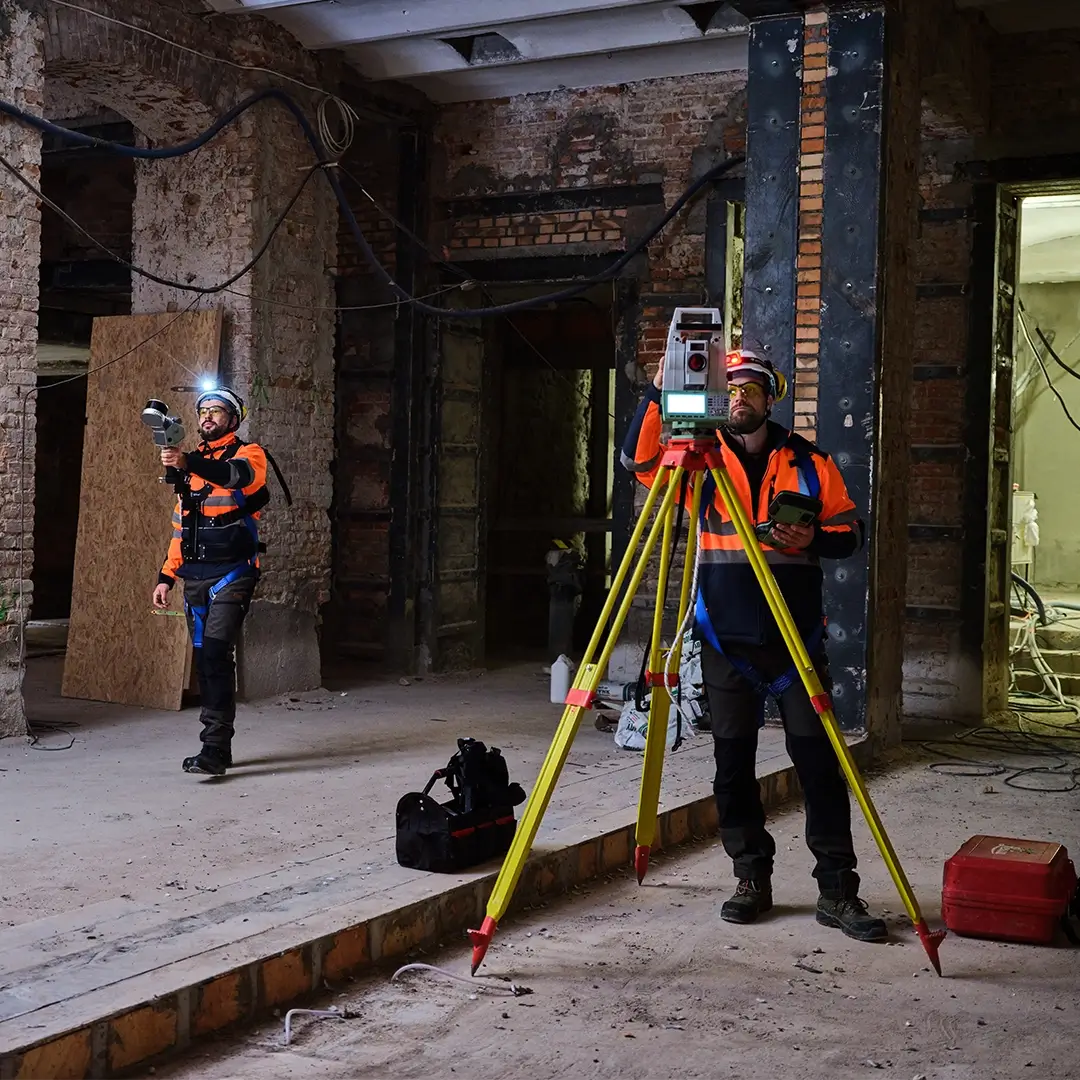
Terrestrial 3D Laser Scanning (TLS)
Highly accurate reproduction of object geometry with millimeter precision.
- Acquisition of high-density point clouds.
- Measurements of buildings, industrial facilities, and infrastructure.
- Reverse engineering and digital twins.
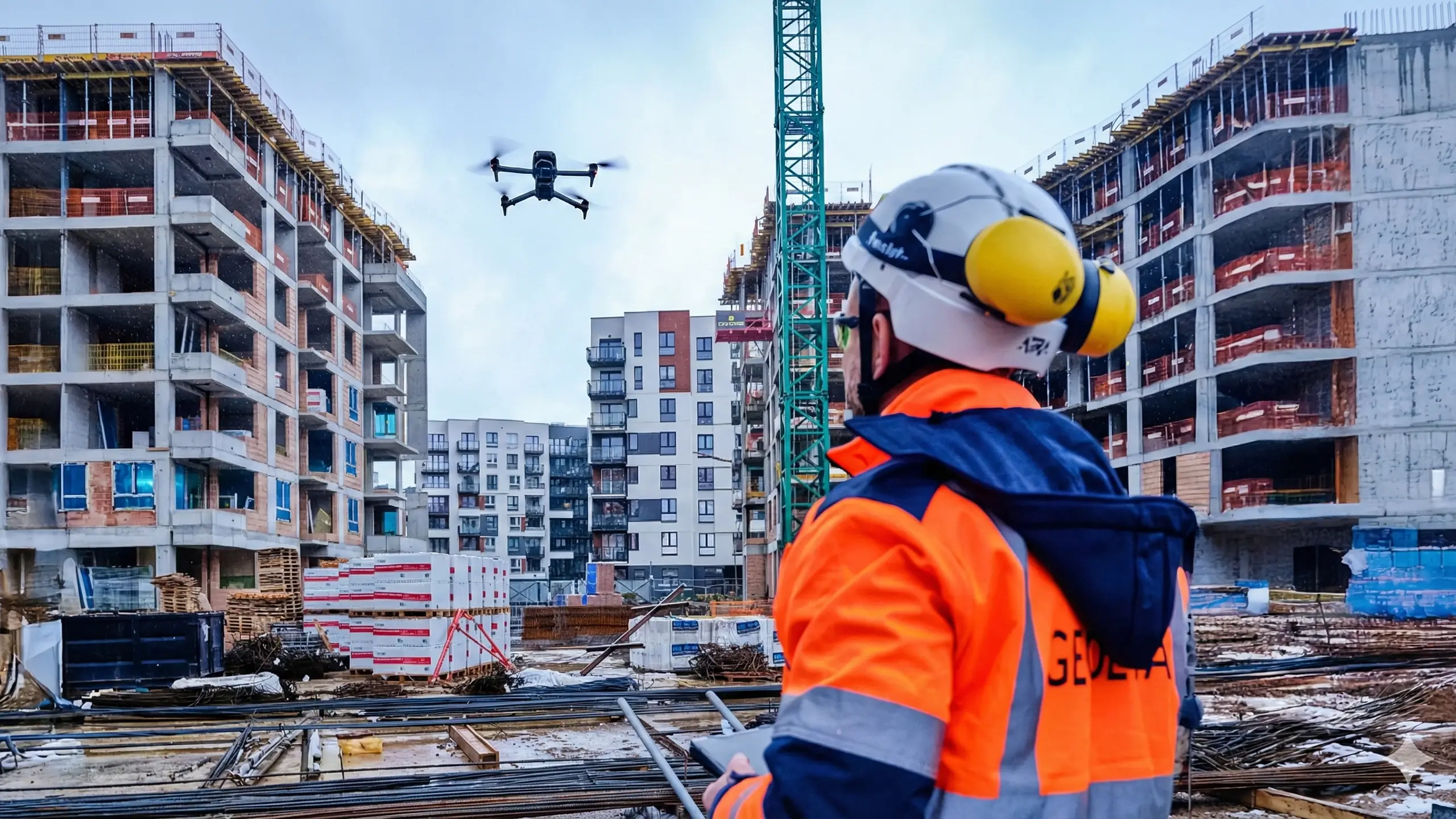
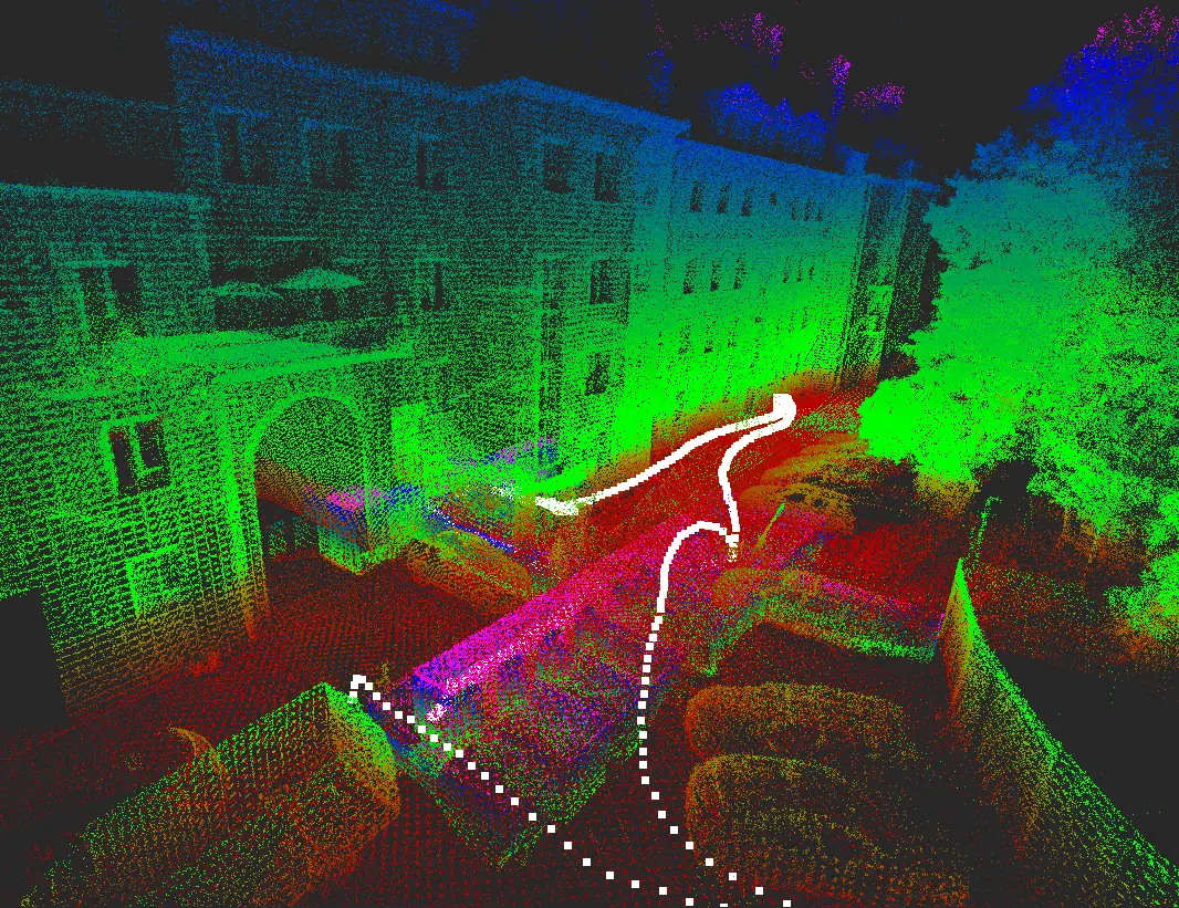
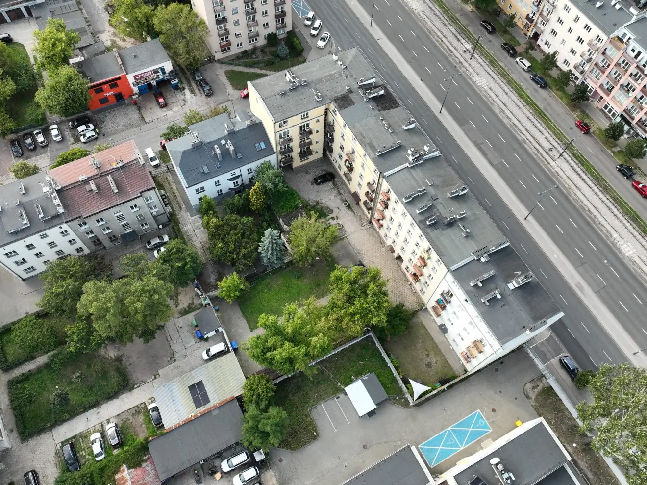
Drone-Based Scanning and Measurements (UAV)
Fast and safe acquisition of spatial data over large areas.
- Photogrammetric flights for open areas and building facades.
- Generation of orthophotos and digital terrain models (DTM).
- Inspections of hard-to-reach structures and roofs.
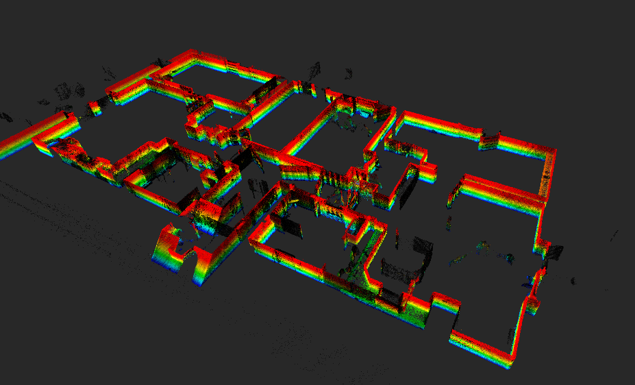
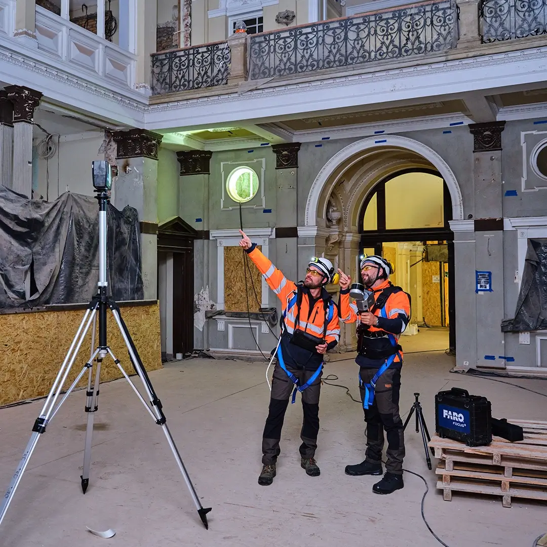
Architectural and Construction Surveys
Professional documentation of the as-built condition using 3D scanning.
- Accurate plans, sections, and elevations of buildings.
- Reference models and dimensional reports.
- As-built documentation and heritage surveys.
3D and BIM Models
Digital processing of survey data into intelligent design models.
- Creation of 3D CAD and BIM models (Revit, Archicad).
- High-detail models (LOD 100–400).
- Clash detection and support for interdisciplinary coordination.
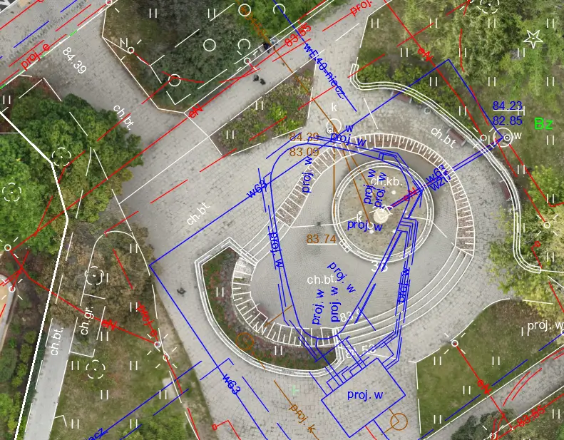
Engineering Analyses and Studies
Advanced geometry control and specialized measurement analyses.
- Measurements of deformations, displacements, and verticality.
- Accurate calculations of earthworks and tank volumes.
- Floor flatness checks and assembly tolerance verification.
Applications of Our Technology
Realization Process
Project Workflow
Definition of Goals and Scope
Specify the required accuracy and deliverables.
Data Acquisition
TLS scanning and/or UAV measurements.
Data Processing
Registration, filtering, integration, and validation.
Deliverables Preparation
Preparation of documentation and datasets in agreed formats (LAS, E57, DWG, IFC, RVT, OBJ).
Standards and Quality
Standards and Quality
- High accuracy and data resolution
- Quality control at every stage of the workflow
- Consistency and repeatability of deliverables
- Compliance with project requirements and BIM/CAD environments
For detailed technical information or quotation, please contact us.